Hiking
Hiking in Chiang Mai
Chiang Mai's hiking sits on two distinct ranges. The Doi Suthep–Pui ridge rises straight out of the western suburbs, with the city's most-walked trail — the Monk's Trail through Wat Pha Lat — and the harder Doi Pui traverse along the spine. Eighty kilometres south, Doi Inthanon National Park holds the highest point in Thailand (2,565 m) and the country's only genuine cloud-forest nature loops. This is the rebuilt guide: trail stats verified against the national park service and season advice that accounts for the burning-season closures.
Updated
The four flagship hikes
Ranked easiest to hardest. Distances are one-way unless the trail is a loop.
EASY · 2.5 km
Doi Inthanon Nature Trail (Kew Mae Pan)
A 2.5 km loop at 2,200 m along the Kew Mae Pan ridge near the summit of Thailand's highest mountain, plus the easier 360 m Ang Ka Luang boardwalk through cloud forest. Ninety minutes for the main loop, no climb worth mentioning, but a local Karen guide is mandatory for Kew Mae Pan from November through May. Open seasonally; closed June through October for bird nesting.
150 m gain · 1.5 h · loop
Read the guide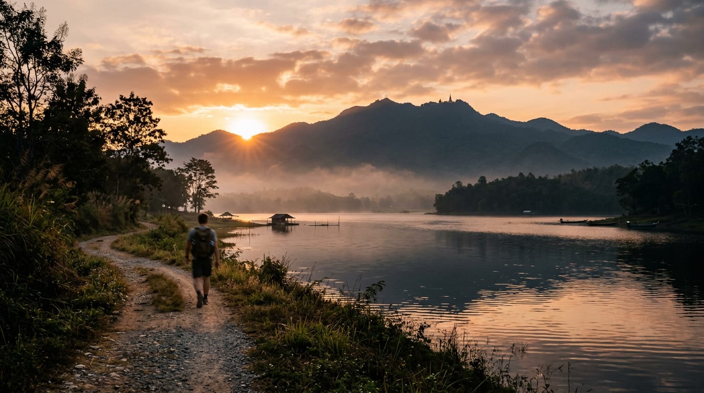
EASY · 4 km
Huay Tung Tao Circular Hike
A flat 4 km loop around the Huay Tung Tao reservoir at the foot of Doi Suthep, 20 minutes from the Chiang Mai Old City. Easy walking on dirt and grass, three swim spots, raft restaurants serving Northern Thai food on the eastern shore, and the only family-friendly hike near the city where strollers and small children manage the whole circuit. Year-round, ninety minutes door-to-door, 50 baht entry.
80 m gain · 1.5 h · loop
Read the guide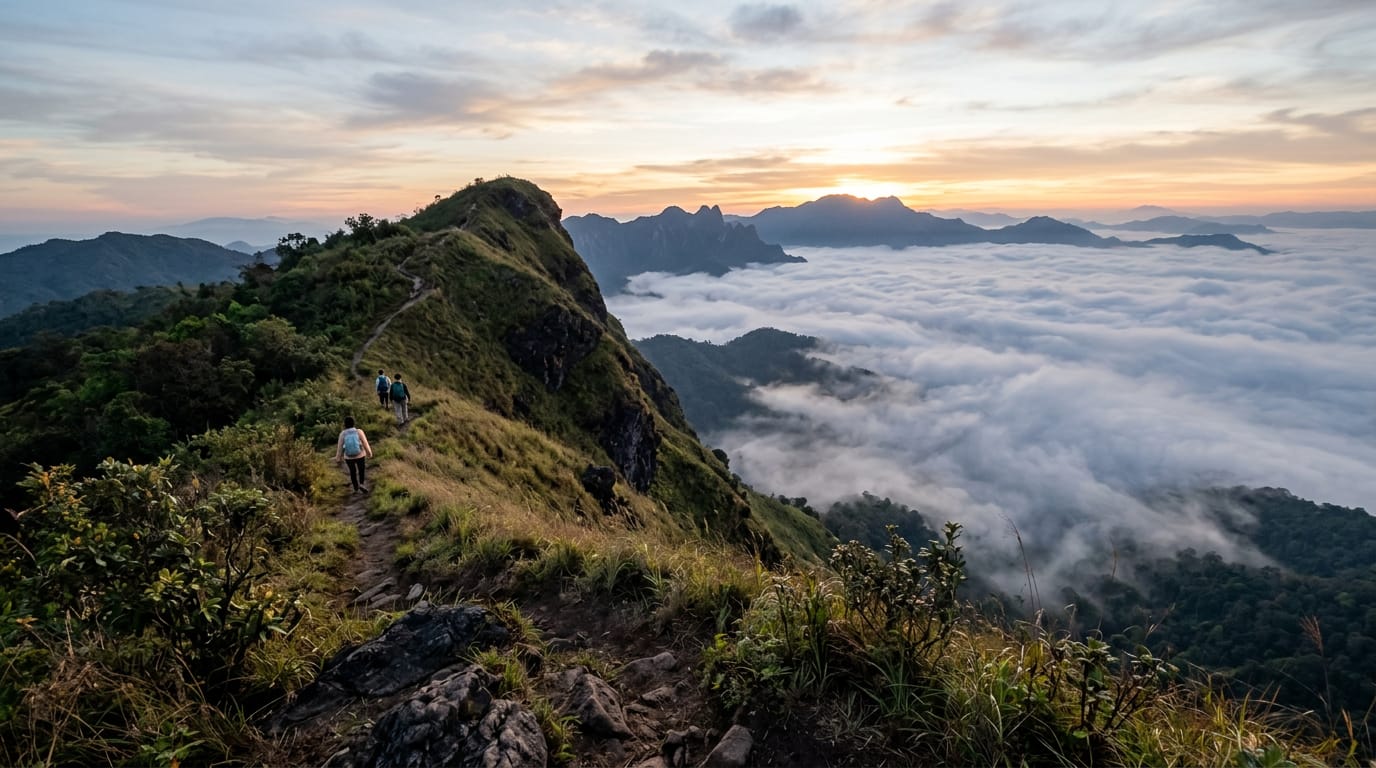
HARD · 8 km
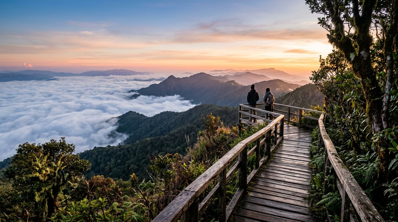
Doi Lanka Noi Loop
An 8 km loop on the southern shoulder of the Doi Lanka range inside Khun Chae National Park, two hours north-west of Chiang Mai. Five hours, 700 m of climb through evergreen montane forest to a 2,031 m summit ridge, with two streams to refill from and a high meadow that holds the last of the morning mist until almost 10:00. Quiet, properly remote, and the best summit day inside a half-day drive of the city.
700 m gain · 5 h · loop
Read the guide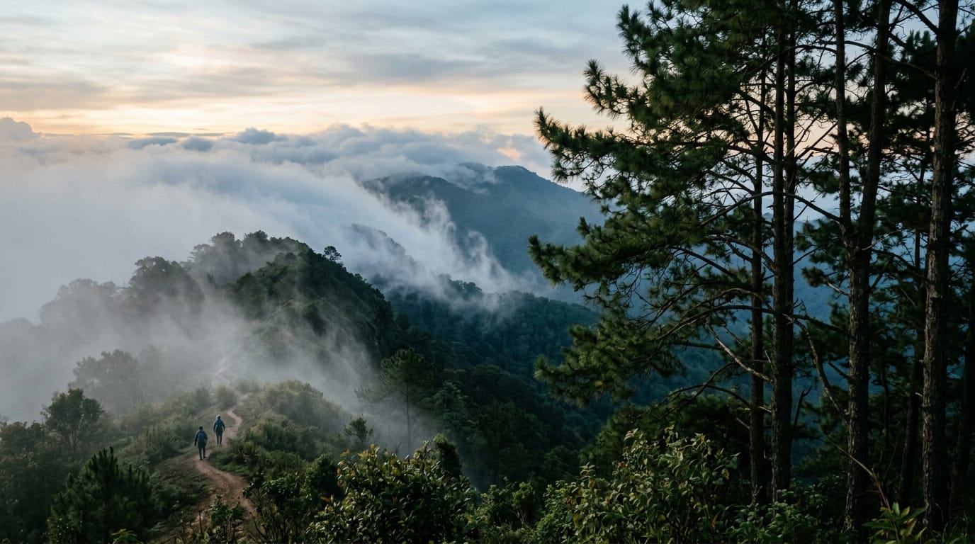
HARD · 13 km
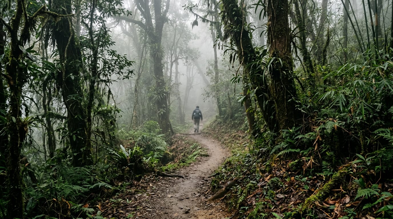
Doi Pui to Doi Suthep Traverse
A classic 13 km point-to-point traverse across the spine of Doi Suthep-Pui National Park, dropping from the Hmong village at Doi Pui (1,685 m) through pine and dipterocarp forest, past Wat Pha Lat, and finishing at the gilded chedi of Wat Phra That Doi Suthep. Six to eight hours, 850 m of climbing, 1,200 m of descent, a couple of springs, and one of the few hikes in northern Thailand where you finish at a working temple with songthaews waiting at the door.
850 m gain · 7 h · point to point
Read the guideHow to choose between them
If this is your first day on the mountain, walk the Monk's Trail from the city up to Wat Pha Lat and decide there whether to continue up to Wat Phra That Doi Suthep — that's about 5.5 km return at a moderate gradient with a temple lunch in the middle. If you want a long ridge day with views, the Doi Pui–to–Doi Suthep traverse is the classic 13-km route along the spine of the range, ending at the Wat. If you came for the highest point in Thailand, drive 70 km south to Doi Inthanon and walk the Kew Mae Pan or Ang Ka nature loops near the summit. The Doi Lanka Noi loop, two hours away in Khun Chae National Park, is a quieter, steeper option for hikers who already know the area.
Season is everything
Chiang Mai hiking has three seasons: cool-and-dry (Nov–Feb, ideal), hot-and-smoky (Mar–Apr, avoid), green monsoon (May–Oct, fine in mornings, prone to afternoon thunderstorms). The burning season closes nearly all trails for at least a few weeks each spring, particularly on Doi Inthanon. Check the Thai Department of National Parks portal for current closure notices.
What to carry
- 2–3 L water per person — refills are rare above 1,000 m
- Light long sleeves for sun and leeches
- 50 baht in coins for the wat at the top, plus the 300-baht park fee in cash for Doi Inthanon
- Headlamp — temple-area trails close at dusk and the descent gets dark fast under canopy
- Offline GPS (OsmAnd, Komoot or Gaia) with the route saved for offline use before you leave the city
Frequently asked questions
What is the best hike in Chiang Mai?
For most visitors, the Monk's Trail to Wat Pha Lat and onward to Doi Suthep is the introductory hike: a 5–6 km out-and-back through forest with a working temple stop and panoramic city views. For a real day on the mountain, the Doi Pui to Doi Suthep traverse is the classic — roughly 13 km along the ridge from the summit village down to the Wat Phra That. Doi Inthanon's nature trails reach the highest point in Thailand at 2,565 m.
When is hiking season in Chiang Mai?
November through February. The air is dry, the trails are firm and temperatures sit between 15 and 26 °C. May to October is monsoon — leeches, slippery descents, dramatic green. March and April are burning-season months: hot, smoky, often closed. Most national-park trails enforce a daylight curfew year-round.
Are there leeches on Chiang Mai trails?
Yes, on the higher Doi Suthep–Pui ridge and on Doi Inthanon's nature loops during the wet season (June to October). Tuck trousers into socks and check after stream crossings. They aren't dangerous, just persistent.
Do I need a permit to hike Doi Inthanon?
You don't need a permit, but Doi Inthanon National Park charges a foreigner entry fee of 300 baht (adult) and 150 baht (child) at the gate, plus 30 baht per car. The fee covers entry to all the loops and the summit. Open 05:30–18:30 daily.
Can I hike Doi Suthep without a guide?
Yes. The Monk's Trail to Wat Pha Lat is well-marked from the start near Chiang Mai University. The trail upward to Wat Phra That Doi Suthep is steeper but obvious. A GPS app like OsmAnd or Komoot helps for the Doi Pui ridge traverse, which has unmarked junctions.
Is hiking in Chiang Mai dangerous?
The mountains are not technically difficult, but heat, dehydration and burning-season air pollution are the real risks. Trail dogs at temples can be territorial. Snakes exist but rarely seen. Carry 2–3 litres of water per person, start early, and avoid March–April.
Do I need a navigation app for these hikes?
Yes, for everything except the Huay Tung Tao loop. Save the route offline in Komoot, OsmAnd, Gaia GPS or AllTrails before leaving the city — mobile signal drops out on the back of Doi Pui and through most of Khun Chae National Park, and the Doi Pui ridge has unmarked junctions.
Are there shorter family-friendly walks?
Yes. The Huay Tung Tao reservoir loop is flat, 4 km, and passes raft restaurants. Doi Inthanon's Kew Mae Pan nature trail at the summit is 2.5 km, mostly boardwalk. Mae Sa waterfall has a 1 km circuit of pools and bridges.